| # | Itinerary | Distance(km) | Highlight |
| 1 |
Toronto --> Rivière-du-Loup |
994 |
|
| 2 |
Rivière-du-Loup --> Percé |
567 |
* Parc national du Bic
* Bay of Chaleur
|
| 3 |
Percé |
20 |
* Walk to Percé Rock at low tide
* Boat tour to Bonaventure Island, bird watching and hiking(7.7km)
* Climb Mt. Sainte-Anne
* Percé Rock at sunset
|
| 4 |
Percé --> Forillon National Park |
172 |
* Cap Blanc Lighthouse
* The Indian Head Rock in Saint-Georges-de-Malbaie
* Cap-Bon-Ami
* Hiking Le Mont Alban Trail to the observation tower
* Anse-aux- Sauvages beach at sunset
|
| 5 |
Forillon National Park |
161 |
* La Chute Trail
* Les Graves Trail along the beach and to Cap Gaspé Lighthouse
* Cap-Des-Rosiers Lighthouse
|
| 6 |
Forillon National Park --> Parc national de la Gaspésie |
264 |
* Cap Madeleine Lighthouse
* La Martre Lighthouse
* Chute Sainte-Anne
|
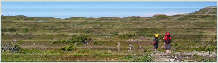
| 7 |
Parc national de la Gaspésie |
7 |
* Hiking Mont Albert Loop and Mont Olivine(20km)
|
| 8 |
Parc Gaspésie --> Saint-Siméon --> Sainte-Anne-de-Beaupre |
535 |
* Grand-Metis Lighthouse
* Pointe-Au-Pere Lighthouse
* Cap Chat Wind Energy Interpretation Centre
* La Grand Rassemblement sculptures in Sainte Flavie
|
| 9 |
Sainte-Anne-de-Beaupre--> home |
843 |
* Canyon Sainte-Anne
* St. Anne de Beaupré Shrines
* Montmorency Fall
* Old Quebec City
|